More Products in category:
GPS PLB Radios
- Garmin inReach® Mini 2 Flame Red
- Garmin Montana 710 GPS Touchscreen Handheld – inReach
- Garmin Montana 710i GPS Touchscreen Handheld – inReach
- Garmin Montana 760i GPS Touchscreen – inReach & 8mp Camera
- Garmin Tread 2 Overland Edition
- GME TX6165 5 W Handheld Radio — Single Unit Only
- GME TX6165 5 W Handheld Radio with Accessories
- GME TX6165TP 5 W Handheld Radio Twin Pack
- GME TX6600STP 5 W CB Handheld Radio Twin Pack
- GPS 73 International
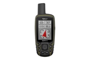
- GPSMAP® 65 Handheld
- GPSMAP® 65S Handheld with Sensors
- Iridium 9555 Satellite Phone Kit
- Iridium 9575 Satellite Phone Kit
- MT610G GPS Personal Locator Beacon
- MT620GR GNSS PLB with Return Link Service
- SPOT GEN4™ Satellite GPS Messenger
- SPOT Trace™
- SPOT X – 2-Way Satellite Messenger
- TX3100 UHF Two Way CB Starter Kit
- TX3350UVP Ultimate Value Pack
- TX3500 UHF Two Way CB Value Pack
- Zoleo Global Satellite Communicator


SIGN UP FOR UPDATES
Subscribe now to receive our specials flyer or newsletter updates. All fields are required *
To add a product to your quote cart, please either log in or create an account.
Garmin Montana 760i GPS Touchscreen – inReach & 8mp Camera


| UOM | |
|---|---|
| SPECS |
Stay on track and in touch with the rugged Montana® 760i handheld GPS navigator with inReach® technology. Built to guide you through all kinds of adventures, it includes TopoActive mapping, a glove-friendly 5” color touchscreen and long battery life. When you go beyond the limits of cell service, stay connected with inReach technology for two-way messaging and interactive SOS alerts (active subscription required; some jurisdictions regulate or prohibit the use of satellite communication devices). Plus, the built-in camera lets you capture and tag the location of your photos along the way.
Features
- Rugged 5” handheld GPS with inReach® satellite communication for off-grid navigation and connectivity (subscription required)
- Two-way messaging, live tracking, interactive SOS and weather updates via the global Iridium® satellite network
- Built-in 8 MP autofocus camera with photo geotagging for location reference and navigation
- Preloaded TopoActive maps and City Navigator® maps; supports additional downloadable maps and marine charts
- MIL-STD 810 rated for thermal, shock and vibration resistance; IPX7 water-resistant
- 32 GB internal memory with Wi-Fi® for map, imagery and content downloads
- High-resolution satellite imagery for landmark-based waypoints
- Multi-GNSS support (GPS & Galileo) for improved positioning accuracy
- Built-in ABC sensors: altimeter, barometer and 3-axis electronic compass
- Rechargeable lithium-ion battery: up to 24 hours in GPS mode, up to 432 hours in expedition mode
- Compatible with Garmin Explore™ and Garmin Connect™ smartphone apps
| Lens Material | Chemically strengthened glass |
| Dimension | 9.19 x 18.30 x 3.27 cm (3.6″ x 7.2″ x 1.3″) |
| Weight | 410g (14.5oz) with included lithium-ion battery pack |
| Water rating | IPX7 |
| MIL-STD-810 | Yes (thermal, shock, water, vibe) |
| Touchscreen | Yes |
| Display Type | WVGA transflective, dual orientation |
| Display Size | 6.48 x 10.80 cm (2.55″W x 4.25″H); 12.70 cm (5″ diag) |
| Display Resolution | 480 x 800 pixels |
| Battery type | Rechargeable lithium-ion (included) |
| Battery life | GPS Mode: up to 24 hours (including when a text message or location is sent every 10 minutes) Expedition Mode: up to 440 hours or up to 300 hours with a text message or location sent every 30 minutes Powered Off: up to 1 year Note – Battery life estimates are with full sky view and can be significantly impacted by obstructions or tree cover. |
| Memory/History | 32 GB (user space varies based on included mapping) |
| Interface | USB-C |
| UOM | |
|---|---|
| SPECS |